File:Sihwa Lake Tidal Power Station 01.png
Tools
Actions
General
Print/export
In other projects
Appearance
From Wikimedia Commons, the free media repository
Sihwa_Lake_Tidal_Power_Station_01.png (740 × 492 pixels, file size: 561 KB, MIME type: image/png)
File information
Structured data
Captions
Captions
Add a one-line explanation of what this file represents
Summary
[edit]DescriptionSihwa Lake Tidal Power Station 01.png |
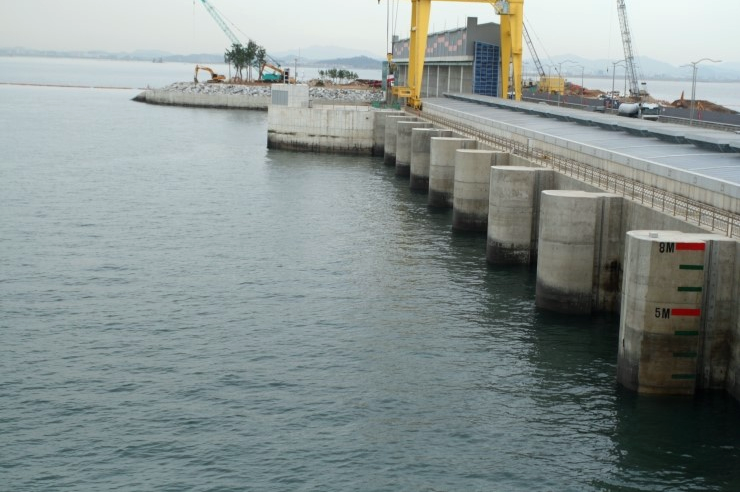
한국어: 시화호조력발전소 English: Sihwa Lake Tidal Power Station |
Date | |
Source | http://blog.naver.com/pfmusic/10122410431 |
Author |
핑크로즈 other versions= |
Camera location | 37° 18′ 45.72″ N, 126° 36′ 33.58″ E ![]() | View this and other nearby images on: OpenStreetMap | ![]() |
---|
Licensing
[edit]

This file is licensed under the Creative Commons Attribution 2.0 Korea license.
- You are free:
- to share – to copy, distribute and transmit the work
- to remix – to adapt the work
- Under the following conditions:
- attribution – You must give appropriate credit, provide a link to the license, and indicate if changes were made. You may do so in any reasonable manner, but not in any way that suggests the licensor endorses you or your use.

File history
Click on a date/time to view the file as it appeared at that time.
Date/Time | Thumbnail | Dimensions | User | Comment | |
---|---|---|---|---|---|
current | 13:11, 26 June 2015 | ![]() | 740 × 492 (561 KB) | Exj (talk | contribs) | User created page with UploadWizard |
You cannot overwrite this file.
File usage on Commons
The following page uses this file:
File usage on other wikis
The following other wikis use this file:
- Usage on bg.wikipedia.org
- Usage on ca.wikipedia.org
- Usage on cy.wikipedia.org
- Usage on en.wikipedia.org
- Usage on fa.wikipedia.org
- Usage on fr.wikipedia.org
- Usage on hr.wikipedia.org
- Usage on ka.wikipedia.org
- Usage on ko.wikipedia.org
- Usage on mk.wikipedia.org
- Usage on nl.wikipedia.org
- Usage on pt.wikipedia.org
- Usage on ru.wikipedia.org
- Usage on sl.wikipedia.org
- Usage on sv.wikipedia.org
- Usage on tr.wikipedia.org
- Usage on vi.wikipedia.org
- Usage on www.wikidata.org
- Usage on zh.wikipedia.org
Metadata
This file contains additional information such as Exif metadata which may have been added by the digital camera, scanner, or software program used to create or digitize it. If the file has been modified from its original state, some details such as the timestamp may not fully reflect those of the original file. The timestamp is only as accurate as the clock in the camera, and it may be completely wrong.
Horizontal resolution | 37.79 dpc |
---|---|
Vertical resolution | 37.79 dpc |
Structured data
Items portrayed in this file
depicts
copyright status<\/a>"}},"text\/plain":{"en":{"":"copyright status"}}},"{\"value\":{\"entity-type\":\"item\",\"numeric-id\":50423863,\"id\":\"Q50423863\"},\"type\":\"wikibase-entityid\"}":{"text\/html":{"en":{"P6216":"<a target=\"_blank\" title=\"d:Special:EntityPage\/Q50423863\" href=https://commons.wikimedia.org/"https:////www.wikidata.org//wiki//Special:EntityPage//Q50423863/">copyrighted/a>"}},"text//plain":{"en":{"P6216":"copyrighted"}}}}" class="wbmi-entityview-statementsGroup wbmi-entityview-statementsGroup-P6216 oo-ui-layout oo-ui-panelLayout oo-ui-panelLayout-framed">
copyright license<\/a>"}},"text\/plain":{"en":{"":"copyright license"}}},"{\"value\":{\"entity-type\":\"item\",\"numeric-id\":44282633,\"id\":\"Q44282633\"},\"type\":\"wikibase-entityid\"}":{"text\/html":{"en":{"P275":"<a target=\"_blank\" title=\"d:Special:EntityPage\/Q44282633\" href=https://commons.wikimedia.org/"https:////www.wikidata.org//wiki//Special:EntityPage//Q44282633/">Creative Commons Attribution 2.0 South Korea<\/a>"}},"text\/plain":{"en":{"P275":"Creative Commons Attribution 2.0 South Korea"}}}}" class="wbmi-entityview-statementsGroup wbmi-entityview-statementsGroup-P275 oo-ui-layout oo-ui-panelLayout oo-ui-panelLayout-framed">
coordinates of the point of view<\/a>"}},"text\/plain":{"en":{"":"coordinates of the point of view"}}},"{\"value\":{\"latitude\":37.312701,\"longitude\":126.609327,\"altitude\":null,\"precision\":1.0e-6,\"globe\":\"http:\\\/\\\/www.wikidata.org\\\/entity\\\/Q2\"},\"type\":\"globecoordinate\"}":{"text\/html":{"en":{"P1259":"37\u00b018'45.724"N, 126\u00b036'33.577"E"}},"text\/plain":{"en":{"P1259":"37\u00b018'45.724\"N, 126\u00b036'33.577\"E"}}}}" class="wbmi-entityview-statementsGroup wbmi-entityview-statementsGroup-P1259 oo-ui-layout oo-ui-panelLayout oo-ui-panelLayout-framed">
37°18'45.724"N, 126°36'33.577"E
inception/a>"}},"text//plain":{"en":{"":"inception"}}},"{/"value/":{/"time/":/"+2011-10-26T00:00:00Z/",/"timezone/":0,/"before/":0,/"after/":0,/"precision/":11,/"calendarmodel/":/"http:////////www.wikidata.org////entity////Q1985727/"},/"type/":/"time/"}":{"text//html":{"en":{"P571":"26 October 2011"}},"text\/plain":{"en":{"P571":"26 October 2011"}}}}" class="wbmi-entityview-statementsGroup wbmi-entityview-statementsGroup-P571 oo-ui-layout oo-ui-panelLayout oo-ui-panelLayout-framed">