
File:Ocean gyres currents blank.png
Size of this preview: 800 × 400 pixels. Other resolutions: 320 × 160 pixels | 640 × 320 pixels | 1,231 × 616 pixels.
Original file (1,231 × 616 pixels, file size: 754 KB, MIME type: image/png)
Captions
Captions
Add a one-line explanation of what this file represents
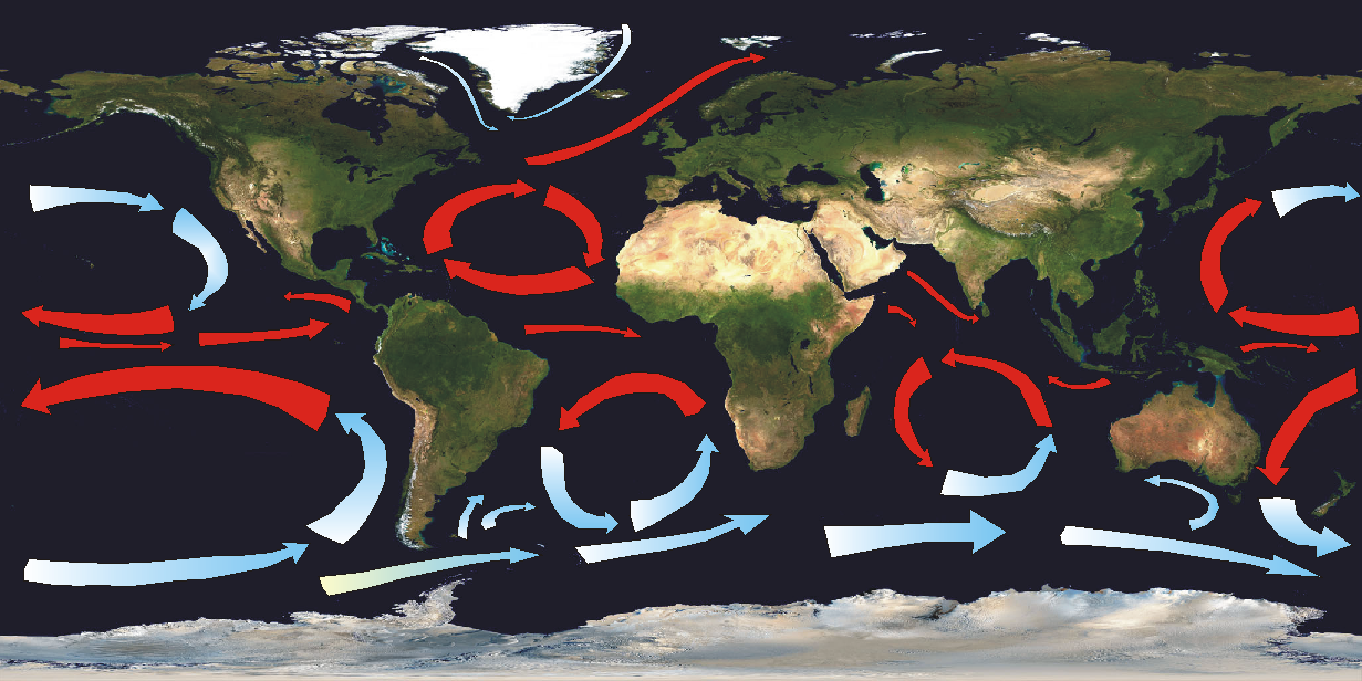
| Description | A map showing the different surface currents in the oceans and the gyres created from it. Currents are imposed upon a satellite photo. |
| Date | (UTC) |
| Source | |
| Author |
|
| This is a retouched picture, which means that it has been digitally altered from its original version. Modifications: Added ocean currents, cold and warm.. The original can be viewed here: Land shallow topo 2048.jpg:
|
This file is licensed under the Creative Commons Attribution-Share Alike 3.0 Unported license.
- You are free:
- to share – to copy, distribute and transmit the work
- to remix – to adapt the work
- Under the following conditions:
- attribution – You must give appropriate credit, provide a link to the license, and indicate if changes were made. You may do so in any reasonable manner, but not in any way that suggests the licensor endorses you or your use.
- share alike – If you remix, transform, or build upon the material, you must distribute your contributions under the same or compatible license as the original.
Original upload log
[edit]
This image is a derivative work of the following images:
- File:Land_shallow_topo_2048.jpg licensed with PD-USGov-NASA
- 2006-01-14T15:31:13Z Haham hanuka 2048x1024 (238676 Bytes) http://veimages.gsfc.nasa.gov//2433/land_shallow_topo_2048.jpg [[Category:Earth]]
Uploaded with derivativeFX
File history
Click on a date/time to view the file as it appeared at that time.
| Date/Time | Thumbnail | Dimensions | User | Comment | |
|---|---|---|---|---|---|
| current | 21:14, 16 November 2010 | | 1,231 × 616 (754 KB) | Ingwik~commonswiki (talk | contribs) | {{Information |Description=A map showing the different surface currents in the oceans and the gyres created from it. Currents are imposed upon a satellite photo. |Source=*File:Land_shallow_topo_2048.jpg |Date=2010-11-16 21:11 (UTC) |Author=*[[:File: |
You cannot overwrite this file.
File usage on Commons
The following page uses this file:
File usage on other wikis
The following other wikis use this file:
- Usage on en.wikipedia.org
- Usage on es.wikipedia.org
- Usage on sv.wikipedia.org