
Category:Aerial photographs of Washington (state)
States of the United States: Alabama · Alaska · Arizona · Arkansas · California · Colorado · Connecticut · Delaware · Florida · Georgia · Hawaii · Idaho · Illinois · Indiana · Iowa · Kansas · Kentucky · Louisiana · Maine · Maryland · Massachusetts · Michigan · Minnesota · Mississippi · Missouri · Montana · Nebraska · Nevada · New Hampshire · New Jersey · New Mexico · New York · North Carolina · North Dakota · Ohio · Oklahoma · Oregon · Pennsylvania · Rhode Island · South Carolina · South Dakota · Tennessee · Texas · Utah · Vermont · Virginia · Washington · West Virginia · Wisconsin · Wyoming – District of Columbia: Washington, D.C.
insular area of the United States: American Samoa · Guam · Northern Mariana Islands · Puerto Rico · United States Virgin Islands – United States Minor Outlying Islands: Baker Island · Midway Atoll · Wake Island
insular area of the United States: American Samoa · Guam · Northern Mariana Islands · Puerto Rico · United States Virgin Islands – United States Minor Outlying Islands: Baker Island · Midway Atoll · Wake Island
English: Aerial photographs of Washington (state).
Subcategories
This category has the following 10 subcategories, out of 10 total.
A
C
Media in category "Aerial photographs of Washington (state)"
The following 198 files are in this category, out of 198 total.
-
.jpg/120px-thumbnail.jpg)
-
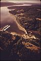
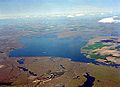
 2016 aerial of Lamoine, Washington.jpg 3,300 × 2,550; 1.79 MB
-
.jpg/120px-2017._An_aerial_view_of_Pacific_madrone_decline_behind_the_pulp_mill._Port_Townsend%2C_Washington._(38897193501).jpg)
-
.jpg/120px-2018-10-21_USA_(2).jpg) 2018-10-21 USA (2).jpg 4,000 × 3,000; 2.32 MB
2018-10-21 USA (2).jpg 4,000 × 3,000; 2.32 MB
-
.jpg/120px-Aerial_-_Interstate_82_just_south_of_Ellensburg%2C_WA_01_(9795466903).jpg) Aerial - Interstate 82 just south of Ellensburg, WA 01 (9795466903).jpg 4,288 × 2,848; 3.6 MB
Aerial - Interstate 82 just south of Ellensburg, WA 01 (9795466903).jpg 4,288 × 2,848; 3.6 MB
-
.jpg/120px-Aerial_-_Interstate_82_just_south_of_Ellensburg%2C_WA_01_-_white_balanced_(9795447124).jpg) Aerial - Interstate 82 just south of Ellensburg, WA 01 - white balanced (9795447124).jpg 4,288 × 2,848; 10.64 MB
Aerial - Interstate 82 just south of Ellensburg, WA 01 - white balanced (9795447124).jpg 4,288 × 2,848; 10.64 MB
-
.jpg/80px-Aerial_-_Interstate_82_just_south_of_Ellensburg%2C_WA_02_(9795342444).jpg) Aerial - Interstate 82 just south of Ellensburg, WA 02 (9795342444).jpg 2,848 × 4,288; 3.63 MB
Aerial - Interstate 82 just south of Ellensburg, WA 02 (9795342444).jpg 2,848 × 4,288; 3.63 MB
-
.jpg/80px-Aerial_-_Interstate_82_just_south_of_Ellensburg%2C_WA_02_-_white_balanced_(9795370465).jpg) Aerial - Interstate 82 just south of Ellensburg, WA 02 - white balanced (9795370465).jpg 2,848 × 4,288; 8.45 MB
Aerial - Interstate 82 just south of Ellensburg, WA 02 - white balanced (9795370465).jpg 2,848 × 4,288; 8.45 MB
-
.jpg/120px-Aerial_-_Ritzville%2C_WA_01_(9794372215).jpg) Aerial - Ritzville, WA 01 (9794372215).jpg 4,288 × 2,848; 4.3 MB
Aerial - Ritzville, WA 01 (9794372215).jpg 4,288 × 2,848; 4.3 MB
-
.jpg/120px-Aerial_-_Ritzville%2C_WA_01_-_white_balanced_(9794496583).jpg) Aerial - Ritzville, WA 01 - white balanced (9794496583).jpg 4,288 × 2,848; 9.76 MB
Aerial - Ritzville, WA 01 - white balanced (9794496583).jpg 4,288 × 2,848; 9.76 MB
-
.jpg/120px-Aerial_-_Ritzville%2C_WA_02_(9794310865).jpg) Aerial - Ritzville, WA 02 (9794310865).jpg 4,288 × 2,848; 4.53 MB
Aerial - Ritzville, WA 02 (9794310865).jpg 4,288 × 2,848; 4.53 MB
-
.jpg/120px-Aerial_-_Ritzville%2C_WA_02_-_white_balanced_(9794382696).jpg) Aerial - Ritzville, WA 02 - white balanced (9794382696).jpg 4,288 × 2,848; 8.46 MB
Aerial - Ritzville, WA 02 - white balanced (9794382696).jpg 4,288 × 2,848; 8.46 MB
-
.jpg/80px-Aerial_-_Wenas_Valley_northwest_of_Selah%2C_WA_01_(9793247586).jpg) Aerial - Wenas Valley northwest of Selah, WA 01 (9793247586).jpg 2,848 × 4,288; 3.85 MB
Aerial - Wenas Valley northwest of Selah, WA 01 (9793247586).jpg 2,848 × 4,288; 3.85 MB
-
.jpg/80px-Aerial_-_Wenas_Valley_northwest_of_Selah%2C_WA_01_-_equalized_(9793282574).jpg) Aerial - Wenas Valley northwest of Selah, WA 01 - equalized (9793282574).jpg 2,848 × 4,288; 11.2 MB
Aerial - Wenas Valley northwest of Selah, WA 01 - equalized (9793282574).jpg 2,848 × 4,288; 11.2 MB
-
.jpg/120px-Aerial_of_Boundary_Dam%2C_1967_(39094244370).jpg) Aerial of Boundary Dam, 1967 (39094244370).jpg 1,200 × 957; 363 KB
Aerial of Boundary Dam, 1967 (39094244370).jpg 1,200 × 957; 363 KB
-
 Aerial of Chief Joseph Dam.jpg 5,472 × 3,648; 11.44 MB
-
.jpg/120px-Aerial_of_Kettle_River_mouth%2C_the_sloughs%2C_Atslukstin%2C_and_Marcus._c._1938._(3cbe0330-d80c-4d18-a448-c6daffcfd35a).jpg)
-
 Aerial of Lamoine, Wash..jpg 1,800 × 1,200; 593 KB
-

-

-
-
 Aerial view from Alaska Air flight 716 2017-10-05.jpg 3,024 × 4,032; 2.09 MB
-
 Aerial view of Burlington railroad bridge.jpg 4,032 × 3,024; 2.61 MB
-
 Aerial view of Cle Elum Lake 01.jpg 2,448 × 3,264; 2.08 MB
-
 Aerial view of Cle Elum Lake 01A.jpg 1,243 × 1,457; 612 KB
-
 Aerial view of Colfax, Washington, circa 1958 - DPLA - bc022cfa20278f3fb054aa403274ea63.jpg 2,574 × 3,982; 1.99 MB
-
.jpg/120px-Aerial_view_of_Eastsound%2C_Wash.%2C_ca._1915_-_DPLA_-_d949e99d52431840ba530e92071bc29f_(page_1).jpg)
-
 Aerial view of Goldendale, WA from the northeast.jpg 3,680 × 2,002; 6.73 MB
-
.jpg/120px-Aerial_View_of_Horseshoe_Basin-Okanogan_Wenatchee_(23300790324).jpg) Aerial View of Horseshoe Basin-Okanogan Wenatchee (23300790324).jpg 1,600 × 1,067; 1.59 MB
Aerial View of Horseshoe Basin-Okanogan Wenatchee (23300790324).jpg 1,600 × 1,067; 1.59 MB
-
.jpg/120px-Aerial_view_of_Lake_Merwin_in_Washington_(35085174512).jpg) Aerial view of Lake Merwin in Washington (35085174512).jpg 3,697 × 2,772; 1.39 MB
Aerial view of Lake Merwin in Washington (35085174512).jpg 3,697 × 2,772; 1.39 MB
-
 Aerial view of Lummi Island.jpg 1,280 × 650; 71 KB
-
.jpg/120px-Aerial_view_of_Marcus._Attached_to_a_35mm_version_of_LARO_2507._Taken_c._1925._(1818666b-6f55-4890-bb91-e0889f7cb016).jpg)
-
 Aerial view of Moses Lake & Potholes Reservoir, Washington 01.jpg 3,264 × 2,448; 1.62 MB
-
 Aerial view of Moses Lake & Potholes Reservoir, Washington 01A.jpg 3,264 × 2,448; 3.02 MB
-
 Aerial view of shipping containers, and big container cranes at Tacoma's container port -a.jpg 4,641 × 3,094; 12.08 MB
-
.jpg/120px-Aerial_view_of_Spokane_River_mouth._Taken_July_10%2C_1932._(3b492518-35c4-4989-a6f3-2eb71d6a32a7).jpg)
-
 Aerial view of Teahwhit Head and James Island.jpg 1,780 × 1,160; 259 KB
-
 Aerial View of Trout Lake.JPG 4,288 × 2,848; 5.85 MB
-
 Aerial view of Winchester Reservoir, Washington 01A.jpg 2,448 × 3,264; 2.03 MB
-
 Air to air photo of the Dash 80 FA239925.jpg 1,293 × 1,600; 509 KB
-
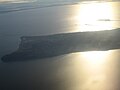
 Alexander Island Washington.jpg 1,920 × 2,560; 1.56 MB
-
 Angle Lake 8262.JPG 4,272 × 2,848; 4.59 MB
-
 Angle Lake 8263.JPG 4,272 × 2,848; 4.68 MB
-
 Angle Lake 8265.JPG 4,272 × 2,848; 2.46 MB
-
 Angle Lake 8266.JPG 4,272 × 2,848; 4.55 MB
-
.jpg/120px-thumbnail.jpg)
-
.jpg/120px-thumbnail.jpg)
-
_in_the_top_left_-_(28764618271).jpg/120px-thumbnail.jpg)
-
.jpg/120px-thumbnail.jpg)
-
 Bear River, Washington - panoramio.jpg 2,560 × 1,920; 1.44 MB
-
 Bellingham Washington Skyline 2021.jpg 1,242 × 773; 622 KB
-
 Bellingham, WA 1907.jpg 677 × 422; 302 KB
-
 BNSF GE Dash-9 at Wishram.jpg 3,965 × 2,448; 2.52 MB
-
 Boeing 367-80 in flight.jpg 1,140 × 760; 234 KB
-
 Bone River, Washington.jpg 2,560 × 1,920; 2.01 MB
-
 Camano Island aerial 01 + 02.jpg 6,824 × 3,712; 8.93 MB
-
 Camano Island aerial 01.jpg 6,000 × 4,000; 8.55 MB
-
 Camano Island aerial 02.jpg 6,000 × 4,000; 8.58 MB
-
.jpg/90px-Carson%2C_Washington_along_the_Banks_of_the_Columbia_River._(1291216113).jpg) Carson, Washington along the Banks of the Columbia River. (1291216113).jpg 1,200 × 1,600; 173 KB
Carson, Washington along the Banks of the Columbia River. (1291216113).jpg 1,200 × 1,600; 173 KB
-
.jpg/120px-Cascade_Locks%2C_Oregon_Along_Columbia_River_(1291999230).jpg) Cascade Locks, Oregon Along Columbia River (1291999230).jpg 1,600 × 1,200; 178 KB
Cascade Locks, Oregon Along Columbia River (1291999230).jpg 1,600 × 1,200; 178 KB
-
 Celilo Falls aerial.jpg 3,553 × 600; 1.23 MB
-
 Centralia Power Plant.jpg 2,519 × 2,519; 4.55 MB
-
 CentraliaCC-USGS.jpg 574 × 431; 153 KB
-
 Chehalis River 07776.JPG 2,560 × 1,920; 1.19 MB
-
 Chief Joseph Dam.jpg 1,500 × 993; 506 KB
-

-
.jpg/120px-Columbia_Glacier%2C_Glacial_Remnant%2C_Cadet_Peak%2C_September_22%2C_1967_(GLACIERS_981).jpg) Columbia Glacier, Glacial Remnant, Cadet Peak, September 22, 1967 (GLACIERS 981).jpg 3,415 × 3,397; 2.55 MB
Columbia Glacier, Glacial Remnant, Cadet Peak, September 22, 1967 (GLACIERS 981).jpg 3,415 × 3,397; 2.55 MB
-
 Corps-engineers-archives bonneville dam looking east.jpg 1,500 × 999; 228 KB
-
.jpg/120px-Crescent_Mountain_and_Lake._slide_(fabd52f45ca9435cb93d76cbdf1524ef).jpg) Crescent Mountain and Lake. slide (fabd52f45ca9435cb93d76cbdf1524ef).jpg 2,168 × 1,479; 905 KB
Crescent Mountain and Lake. slide (fabd52f45ca9435cb93d76cbdf1524ef).jpg 2,168 × 1,479; 905 KB
-
.jpg/120px-Crescent_Mountain_and_Lake._slide_(fc95738a502147949f4180bb90d7d886).jpg) Crescent Mountain and Lake. slide (fc95738a502147949f4180bb90d7d886).jpg 2,168 × 1,479; 930 KB
Crescent Mountain and Lake. slide (fc95738a502147949f4180bb90d7d886).jpg 2,168 × 1,479; 930 KB
-
 DSC00988 YAKIMA, WASHINGTON FROM THE EAST AT 3000 FEET OVERHEAD.jpg 2,161 × 1,366; 1.27 MB
-
 Dwight Merkel Sports Complex & Joe Albi Stadium.png 1,275 × 847; 1.74 MB
-
 Ecotrust.jpg 2,560 × 1,920; 1.72 MB
-
 Eliza Island.jpg 497 × 292; 62 KB
-
 Elk River, Washington - panoramio.jpg 2,560 × 1,920; 1.97 MB
-
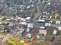
.jpg/120px-Enumclaw%2C_Washington_(3600810744).jpg) Enumclaw, Washington (3600810744).jpg 3,264 × 2,448; 3 MB
Enumclaw, Washington (3600810744).jpg 3,264 × 2,448; 3 MB
-
.jpg/120px-Flight_from_LAS_to_YVR_-_35_years_after_the_eruption_-_the_remnants_of_Mt_St._Helens_and_Spirit_Lake_-_(22394245577).jpg)
-
.jpg/80px-Flight_from_YVR_to_Las_Vegas_-_over_the_Columbia_River_gorge_(15033720603).jpg) Flight from YVR to Las Vegas - over the Columbia River gorge (15033720603).jpg 1,414 × 2,121; 1.42 MB
Flight from YVR to Las Vegas - over the Columbia River gorge (15033720603).jpg 1,414 × 2,121; 1.42 MB
-
.jpg/120px-Flight_from_YVR_to_Las_Vegas_-_Point_Roberts_abnd_the_Tswassen_BC_Ferries_terminal_(15467220109).jpg)
-
 Franklin Delano Roosevelt Lake, WA.JPG 2,592 × 1,944; 912 KB
-
 FRUIT ORCHARDS NEAR CHELAN - NARA - 547995.jpg 3,000 × 2,018; 815 KB
-
 Goldendale WA aerial.jpg 2,552 × 1,912; 2.71 MB
-
 Good's Hill, Colfax, Washington, circa 1935 - DPLA - 96e952fbdbe15c5d732651ec5fcbd4ba.jpg 1,989 × 1,266; 1.05 MB
-
 Hanford - B Area in WWII.crop.jpg 1,032 × 725; 316 KB
-
 Heather, Washington - panoramio.jpg 2,560 × 1,920; 2.49 MB
-
 Hoh River, Washington - panoramio.jpg 1,920 × 2,560; 1.45 MB
-
.jpg/120px-Holzgrove_000020_158381_498836_4578_(35502216084).jpg) Holzgrove 000020 158381 498836 4578 (35502216084).jpg 1,920 × 1,850; 1.75 MB
Holzgrove 000020 158381 498836 4578 (35502216084).jpg 1,920 × 1,850; 1.75 MB
-
 Hood Canal 07771.JPG 2,378 × 1,784; 567 KB
-
 I-90 Snoqualmie Ridge East of North Bend, Washington.jpg 3,264 × 2,448; 3.73 MB
-
 I5LewisFlooding.jpg 700 × 525; 50 KB
-
 IMG 9097FDRlake.JPG 2,592 × 1,944; 3.77 MB
-
 ISS053-E-17199 - View of Earth.jpg 4,928 × 3,280; 2.12 MB
-
.jpg/120px-Issaquah%2C_Washington_(3599950503).jpg) Issaquah, Washington (3599950503).jpg 3,264 × 2,448; 4.09 MB
Issaquah, Washington (3599950503).jpg 3,264 × 2,448; 4.09 MB
-
.jpg/120px-Issaquah%2C_Washington_(3600759940).jpg) Issaquah, Washington (3600759940).jpg 3,264 × 2,448; 4.1 MB
Issaquah, Washington (3600759940).jpg 3,264 × 2,448; 4.1 MB
-
 Jolly Mountain aerial 20170830.jpg 4,160 × 3,120; 827 KB
-
 Jolly Mountain fire 2017 08 30-23.42.46.748-CDT.jpg 4,160 × 3,120; 601 KB
-
.jpg/120px-Kennewick-ColumbiaRiverAerial_(31695765421).jpg) Kennewick-ColumbiaRiverAerial (31695765421).jpg 2,400 × 1,800; 1.54 MB
Kennewick-ColumbiaRiverAerial (31695765421).jpg 2,400 × 1,800; 1.54 MB
-
 Klickitat, Washington - panoramio.jpg 1,024 × 767; 436 KB
-
 LaCrosse, Washington, circa 1900 - DPLA - 52300b7f08eb9f466a53edd3536a4aac.jpg 1,591 × 914; 252 KB
-
.jpg/120px-Lake_Lenore%2C_Washington_(2221854065).jpg) Lake Lenore, Washington (2221854065).jpg 3,072 × 2,304; 1.48 MB
Lake Lenore, Washington (2221854065).jpg 3,072 × 2,304; 1.48 MB
-
.jpg/120px-Lake_Lenore%2C_Washington_(2222644040).jpg) Lake Lenore, Washington (2222644040).jpg 3,072 × 2,304; 1.17 MB
Lake Lenore, Washington (2222644040).jpg 3,072 × 2,304; 1.17 MB
-
 Lake Ozette, Washington - panoramio.jpg 2,560 × 1,920; 1.83 MB
-
 Leadbetter Point, Washington - panoramio.jpg 2,560 × 1,920; 1.93 MB
-
 Leadbetter Point.jpg 1,731 × 1,153; 558 KB
-
 Lewis and Clark Bridge from the air.jpg 6,000 × 4,000; 20.16 MB
-
 Longview Fibre, Longview, Washington - panoramio.jpg 2,560 × 1,920; 1.41 MB
-
 Longview with bridge.jpg 1,600 × 1,179; 303 KB
-
 Looking east to Snoqualmie Valley, North Bend and Mount SI.jpg 3,264 × 2,448; 3.33 MB
-
 Lyle, Washington - panoramio.jpg 1,024 × 767; 468 KB
-
 Maryhill Loop Road from air.jpg 2,848 × 2,613; 2.26 MB
-
 Maryhill Loops Road from air, cloud shadow.jpg 1,302 × 1,190; 726 KB
-
 Maryhill Loops Road, Washington - panoramio.jpg 1,024 × 936; 416 KB
-
 McNeil Island and neighbors, Washington.jpg 1,280 × 775; 137 KB
-
.jpg/120px-MIA-YVR_aerial_shots_-_over_the_N_Cascades_in_Washington_-_Mt_Baker_at_top_-_(19341627265).jpg)
-
 MODIS - Washington state wildfires 2015-08-22.jpg 3,078 × 1,846; 697 KB
-
 MODIS 2015-213 - Wolverine Fire and smoke over Washington and Idaho.jpg 3,600 × 2,800; 1.95 MB
-
 MODIS Washington wildfires 7 18 2014.jpg 1,629 × 1,150; 319 KB
-
.jpg/120px-Monroe%2C_Washington_aerial_view%2C_looking_east_(2708128762).jpg) Monroe, Washington aerial view, looking east (2708128762).jpg 3,264 × 2,448; 3.48 MB
Monroe, Washington aerial view, looking east (2708128762).jpg 3,264 × 2,448; 3.48 MB
-
 Mount Adams summit area.jpg 3,075 × 2,201; 3.12 MB
-
.jpg/120px-Mount_Anderson%2C_September_28%2C_1967_(GLACIERS_1612).jpg) Mount Anderson, September 28, 1967 (GLACIERS 1612).jpg 3,384 × 3,384; 1.55 MB
Mount Anderson, September 28, 1967 (GLACIERS 1612).jpg 3,384 × 3,384; 1.55 MB
-
.jpg/120px-Mount_Anderson%2C_September_28%2C_1967_(GLACIERS_1613).jpg) Mount Anderson, September 28, 1967 (GLACIERS 1613).jpg 3,456 × 3,456; 1.71 MB
Mount Anderson, September 28, 1967 (GLACIERS 1613).jpg 3,456 × 3,456; 1.71 MB
-
 Mount Olympus, Washington - panoramio.jpg 2,560 × 1,920; 1.82 MB
-
 Mount Rainier peak with Puget Sound in the foreground 2.jpg 6,000 × 4,000; 17.2 MB
-
 Mount Rainier peak with Puget Sound in the foreground.jpg 6,000 × 4,000; 18.67 MB
-
.jpg/120px-Mount_St._Helens_aerial_(31819021374).jpg) Mount St. Helens aerial (31819021374).jpg 4,000 × 3,000; 2.6 MB
Mount St. Helens aerial (31819021374).jpg 4,000 × 3,000; 2.6 MB
-
.jpg/114px-Mount_St._Helens_Eruption_—_1980_(11707592844).jpg) Mount St. Helens Eruption — 1980 (11707592844).jpg 1,329 × 1,400; 1.18 MB
Mount St. Helens Eruption — 1980 (11707592844).jpg 1,329 × 1,400; 1.18 MB
-
.jpg/120px-Mt._Adams%2C_Washington_(1419062186).jpg) Mt. Adams, Washington (1419062186).jpg 3,008 × 2,000; 1.77 MB
Mt. Adams, Washington (1419062186).jpg 3,008 × 2,000; 1.77 MB
-
 Nahcotta, Washington - panoramio.jpg 2,560 × 1,920; 2.1 MB
-
 North Bend, Washington 98045.jpg 647 × 800; 397 KB
-
 North Bend, Washington and Mount Si.jpg 3,264 × 2,448; 2.94 MB
-
 Odessa, Washington.png 982 × 731; 989 KB
-
 Olympic Mountains from the south.jpg 6,000 × 4,000; 18.16 MB
-
 Osulivan.jpg 337 × 245; 11 KB
-
.jpg/120px-P042214PS-0143_(14328814491).jpg) P042214PS-0143 (14328814491).jpg 1,500 × 1,000; 283 KB
P042214PS-0143 (14328814491).jpg 1,500 × 1,000; 283 KB
-
 Point Roberts aerial view.jpg 2,272 × 1,704; 1.17 MB
-
 Point roberts airpark.jpg 800 × 600; 85 KB
-
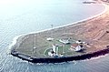 Point Wilson Washington aerial view.jpg 1,800 × 1,188; 778 KB
-
.jpg/120px-Protection_Island_(WA).jpg) Protection Island (WA).jpg 1,320 × 1,037; 436 KB
Protection Island (WA).jpg 1,320 × 1,037; 436 KB
-
 Puget Island from the north 2.jpg 1,600 × 1,066; 343 KB
-
 Puget Island from the north.jpg 6,000 × 3,047; 11.82 MB
-
 Quarry, South of Monroe, Washington.jpg 3,264 × 2,448; 3.18 MB
-
 Queets River, Washington - panoramio.jpg 2,560 × 1,920; 1.91 MB
-
 Quinault Beach Resort and Casino from above 2.jpg 2,663 × 2,081; 3.6 MB
-
 Quinault Beach Resort and Casino from above.jpg 6,000 × 4,000; 15.59 MB
-
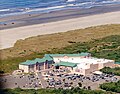
.jpg/120px-Redondo_Fred_Meyer_(16259328901).jpg) Redondo Fred Meyer (16259328901).jpg 5,184 × 3,456; 10.94 MB
Redondo Fred Meyer (16259328901).jpg 5,184 × 3,456; 10.94 MB
-
 Regional Athletic Complex aerial view.jpg 6,000 × 4,000; 16.46 MB
-
 Regional Athletic Complex.jpg 6,000 × 4,000; 16.79 MB
-
 Ridge Motorsports Park - Shelton Washington - aerial.jpg 4,032 × 1,914; 3.79 MB
-
 Ross Dam USACE 20031022.jpg 1,536 × 1,895; 446 KB
-
.jpg/120px-Seattle-fireboat-P-UHD-4000x2250-16x9_(34534969242).jpg) Seattle-fireboat-P-UHD-4000x2250-16x9 (34534969242).jpg 4,000 × 2,250; 6.62 MB
Seattle-fireboat-P-UHD-4000x2250-16x9 (34534969242).jpg 4,000 × 2,250; 6.62 MB
-
 Sedro-Woolley High School Looking East copy.jpg 2,958 × 1,948; 896 KB
-
 Silver Lake, Washington aerial.jpg 4,288 × 2,848; 3.63 MB
-
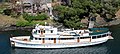
 Skagit Chief, Skagit Bell, and WT Preston race 1950.jpg 1,042 × 601; 234 KB
-
 Skokomish River 07774.JPG 2,560 × 1,920; 1.13 MB
-
 Skokomish River 07775.JPG 2,560 × 1,920; 1.14 MB
-
 Skokomish River Delta 07772.JPG 2,560 × 1,920; 1.34 MB
-
 Skokomish River Delta 07773.JPG 2,560 × 1,920; 1.24 MB
-
 Snoqualmie Falls, 2008.jpg 3,264 × 2,448; 3.15 MB
-
 Sooes River, Washington - panoramio.jpg 2,560 × 1,920; 1.71 MB
-
 South of Monroe, Washington.jpg 3,264 × 2,448; 3.25 MB
-
 Spada Lake west of Glacier Peak.jpg 2,592 × 1,944; 1.94 MB
-
 Spokane aerial.jpg 3,072 × 3,063; 3.11 MB
-
 Spokane River & a Golf Course.png 1,277 × 966; 2.13 MB
-
.jpg/120px-Stabler%2C_Washington_(1291218575).jpg) Stabler, Washington (1291218575).jpg 1,600 × 1,200; 186 KB
Stabler, Washington (1291218575).jpg 1,600 × 1,200; 186 KB
-
 Steamboat Rock State Park aerial 01.jpg 4,288 × 2,848; 3.5 MB
-
 Steamboat Rock State Park aerial 01A.jpg 4,288 × 2,848; 9.21 MB
-
 Sturgeonlake or.jpg 2,306 × 1,631; 600 KB
-
 Tacoma Narrows Bridge in 2023.jpg 6,000 × 4,000; 15.49 MB
-
 Tatoosh Island-flickr-1796635990.jpg 1,024 × 680; 196 KB
-
.jpg/102px-The_Residence_Inn%2C_Pullman%2C_Wa_(17797142489).jpg) The Residence Inn, Pullman, Wa (17797142489).jpg 3,024 × 3,555; 6.51 MB
The Residence Inn, Pullman, Wa (17797142489).jpg 3,024 × 3,555; 6.51 MB
-
.jpg/120px-Tieton_Dam_(4307002068).jpg) Tieton Dam (4307002068).jpg 800 × 600; 131 KB
Tieton Dam (4307002068).jpg 800 × 600; 131 KB
-
 Tugboat towing a Barge off Lummi Island.jpg 3,264 × 2,448; 2.26 MB
-
 USACE Lower Monumental Dam.jpg 1,500 × 1,051; 536 KB
-
 USACE sediment retention structure Toutle River.jpg 1,500 × 1,030; 649 KB
-
 Vancouver Lake, aerial shot from Oregon.jpg 6,000 × 2,135; 7.22 MB
-
 Vancouver Lake.jpg 4,032 × 3,024; 2.15 MB
-
 VancouverWashingtonAerial.jpg 4,288 × 2,848; 4.87 MB
-
 View of Colfax, Washington, circa 1900 - DPLA - 105885050942655502bf728ea4f1ebd5.jpg 2,041 × 1,579; 1,014 KB
-
 View of Puget Sound Navy Yard and Bremerton, circa in March 1945.jpg 3,955 × 2,660; 3.86 MB
-
 Wahkiakum County ferry at dock on Washington side, from above 2.jpg 6,000 × 4,000; 13.85 MB
-
 Wahkiakum County ferry at dock on Washington side, from above.jpg 6,000 × 4,000; 18.56 MB
-
 Waitsburg Washington aerial photo - downtown 1.jpg 4,032 × 3,024; 4.57 MB
-
 Waitsburg Washington aerial photo - downtown 2.jpg 3,867 × 2,861; 4.2 MB
-
 Waitsburg Washington aerial photo - looking southwest 1.jpg 4,456 × 2,859; 4.32 MB
-
 Waitsburg Washington aerial photo - looking southwest 2.jpg 3,476 × 2,158; 2.74 MB
-
.jpg/81px-Washington_-_Near_Vancouver_06-1973_(4272310140).jpg) Washington - Near Vancouver 06-1973 (4272310140).jpg 2,033 × 3,000; 1.4 MB
Washington - Near Vancouver 06-1973 (4272310140).jpg 2,033 × 3,000; 1.4 MB
-
 Washington Corrections Center - aerial.jpg 4,032 × 3,024; 5.26 MB
-
.jpg/120px-Washington_State_-_panoramio_(1).jpg) Washington State - panoramio (1).jpg 3,956 × 2,225; 1.33 MB
Washington State - panoramio (1).jpg 3,956 × 2,225; 1.33 MB
-
.jpg/120px-Washington_State_-_panoramio_(2).jpg) Washington State - panoramio (2).jpg 3,762 × 2,116; 1.2 MB
Washington State - panoramio (2).jpg 3,762 × 2,116; 1.2 MB
-
 Washington State - panoramio.jpg 3,927 × 2,209; 1.49 MB
-
 Wenatchee MODIS 2021-07-03 and 2021-07-05.jpg 1,082 × 410; 85 KB
-
.jpg/90px-WestPasco-ColumbiaRiverAerial-Feb2016_(31695765091).jpg) WestPasco-ColumbiaRiverAerial-Feb2016 (31695765091).jpg 1,800 × 2,400; 1.64 MB
WestPasco-ColumbiaRiverAerial-Feb2016 (31695765091).jpg 1,800 × 2,400; 1.64 MB
-
 Wilbur, Washington aerial 01.jpg 4,288 × 2,848; 3.59 MB
-
 Wilbur, Washington aerial 01A.jpg 4,288 × 2,848; 9.5 MB
-
 Willapa clearcutting.jpg 952 × 657; 632 KB
-
.jpg/120px-Wind_River_Road_(1292080180).jpg) Wind River Road (1292080180).jpg 1,600 × 1,200; 178 KB
Wind River Road (1292080180).jpg 1,600 × 1,200; 178 KB
-
 Wynoochee Dam.png 557 × 710; 279 KB
-
 Yacht Malibu.jpg 1,758 × 794; 758 KB
.jpg)

.jpg)
.jpg)
.jpg)
.jpg)
.jpg)
.jpg)
.jpg)
.jpg)
.jpg)
.jpg)
.jpg)
.jpg)
.jpg)

.jpg)


.jpg)

.jpg)
.jpg)

.jpg)


.jpg)


.jpg)
.jpg)
_in_the_top_left_-_(28764618271).jpg)
.jpg)


.jpg)
.jpg)


.jpg)

.jpg)
.jpg)


.jpg)
.jpg)
.jpg)
.jpg)


.jpg)


.jpg)
.jpg)


.jpg)


.jpg)
.jpg)


.jpg)


.jpg)

.jpg)
.jpg)


.jpg)
.jpg)
.jpg)


.jpg)


.jpg)


.jpg)


.jpg)


.jpg)


.jpg)
.jpg)


.jpg)

.jpg)
.jpg)

.jpg)


.jpg)

